Hike or Bike the White River Valley Trail System
Hikers and mountain bikers enjoy the challenging treks hidden inside the White River Valley Trail System.
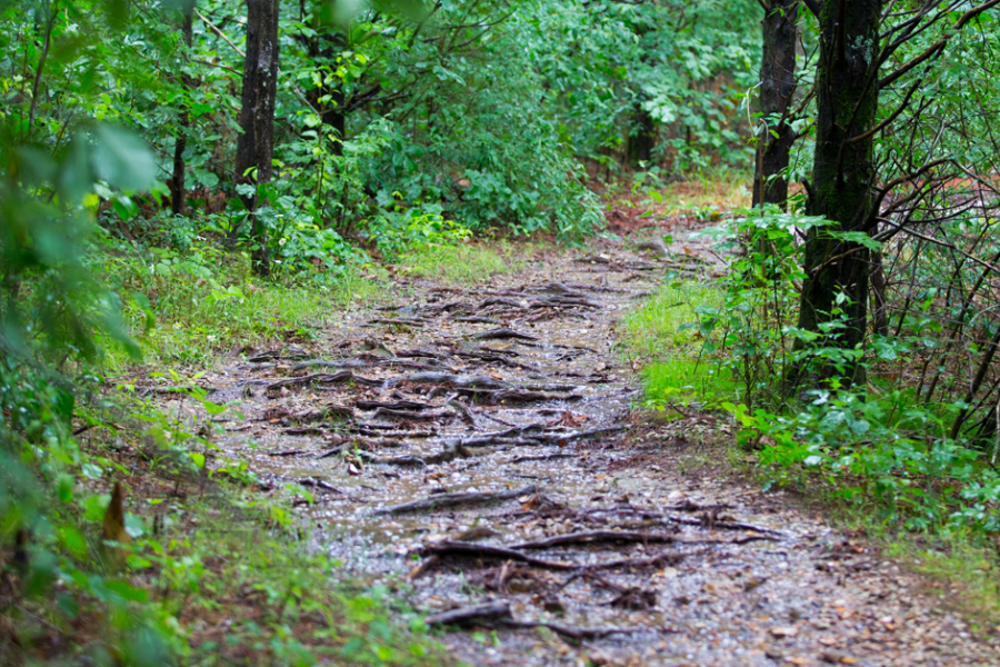
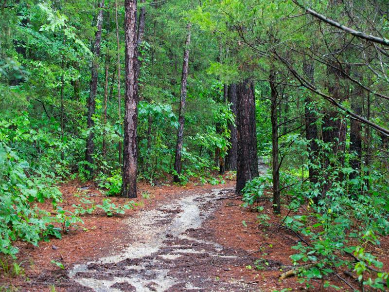
The White River Valley Trail Systems hosts four loops, each varying in length, scenery, difficulty and terrain. This trail system is not for the weak, as elevation ranges from 710 feet to nearly 1,200 feet above sea level. Throughout your adventure, you will see the terrain and scenery change drastically from moist and low to dry and high. Beautiful sights of Table Rock Lake, stunning tree species, old roads, small waterfalls and an abandoned farmstead are waiting for you along the way.
Please note: as part of this system is located on Corps of Engineers land, some portions of the trail may be closed during hunting seasons. There is also no backpacking or camping allowed throughout the system.
Red Loop
Adventurers seeking the most challenging trek head to the Red Loop. If you have any doubt in your cycling abilities, this may not be the trail for you, as protruding rocks and advanced degrees of elevation await. You will find a filtration pond at the north end of the loop designed to catch silt from the dam construction era, and you will likely see beavers and other waterfall while taking at pit stop at the pond. White connector 1 is located near the center of the loop to allow for shorter trail experience. Additionally, on the east side of the pond, White connector 2 runs for .50 miles to join the Blue Loop.
Blue Loop
Nature lovers and endurance enthusiasts prefer to trek the Blue Loop. You will see diverse nature scenes as portions of the trail skirt Table Rock Lake. There is also 400 feet of elevation gain to experience along the way. During hunting seasons, White connector 3 near the middle of the trail will indicate the closure point of the Blue Loop. To access the Blue Loop, follow White connectors 2 and 4, or the Lake Taneycomo parking area down the hill from the dam’s scenic overlook.
Orange Loop
Looking for the shortest trail in the system? Orange Loop is just that. Prepare to see small waterfalls, and to endure a slight elevation increase. The only way to find the Orange Loop is by following White connectors 4 and 5. Find White connector 4 from the Blue Loop to the north, and White connector 5 lies to the south of the Orange Loop and connects to the Green Loop. If you take White connector 5 to reach the orange loop, you will find an old and abandoned farm homestead.
Green Loop
For a stunning view of the Ozarks, look no further than the 1,200 feet elevation gain on the Green Loop. As you head toward the finish line, see grassland, glade and woods along the way. Access to the Green Loop can be found from the trailhead at Trophy Run Road or from white connector 5 on the north side of the loop.
Stay safe on the trails by following our top safety tips for bikers.
You May Also Like
A Complete Guide to Table Rock Lake
Planning a vacation to the lake? This Guide to Table Rock Lake will equip you with everything you need to know about…
Branson Parks & Recreation Facilities
Spread throughout 300+ acres, ranging from small neighborhood parks to large wilderness areas with hiking trails, the…
2025 Fall Festivals in Branson
As the balmy days of summer gradually give way to the crisp and cozy embrace of fall, there's a place where the spirit…
Waterfall Trail: A Scenic, Convenient Hike in Branson
Branson's uniqueness is highlighted by the ability to be in the middle of town and still see lots of natural beauty…
Kayaking in Branson
If your calendar is clear for the first time in weeks, the sun is shining and you’re ready to get outdoors, it’s time…
Paddleboarding in Branson
Stand-up paddleboarding (SUP) is the perfect outdoor adventure and method of transportation for exploring Branson’s…